 This screen shot shows an exhibit of Irish Government Ministers travel on Government aircraft in 2010 using this data via Ken Foxe's FOI's
I made the 2008 and 2009 travel exhibits last year when Ken Foxe put up the Freedom of Information requests of the Ministers Air Travel it hasn't got many views although I haven't promoted it a lot, but it didn't get as much notice or use as I hoped,I thought it could be a prototype for visual data journalism in Ireland I'm not sure of displayed entirely correctly or usefully for people but the one thing that was incomplete is the purpose of the visits, its unfair to show the travel without context of why they travelled, I should have spent as much as much time searching for that information, it takes a lot of work to go find the reason for the trip, even when the St Patrick's day ministerial travel was put out it was only one line of information they gave out to news organisations to explain what the ministers were doing when the flew around the world for March 17th. I couldn't hope to find details of every last trip myself and left it to other people to help find it, but its been difficult to find a quick and easy way to allow people add info to the Exhibit on the web page itself as opposed the google doc.
Its pity there no way to batch search, so I could quickly find why Mary Harney was in Helsinki in 2009 and Michael Martin went to New York in July 2010, although google Timeline has been useful Brian Cowen New York
If there was a way to search for trip keywords and return the top and allow people 1 click to confirm the relevant result? To gamify data correction. This hasn't been possible with google docs, but maybe possible with google apps. The only place I've seen something like that is Freebase's, acre apps like matchmaker
They could drown you in information but they don't? Government communications is still stuck in the notion of giving info to the press rather then the public, or its hard to find on their websites, although merrionstreet.ie may now make it easier to find information on the government. I need regular engaging posts to get links that's hard to do with old information thats incomplete, I guess that's where the actual journalism of the Sunday Tribune's Ken Foxe's comes in. I could suggest that the amount of trips and therefore the costs has reduced significantly from 2008 to 2010, although Im missing the data from the last months of 2009 and 2010, so I can't compare definitively as yet.
The source
Ken Foxe of the Sunday Tribune has been requesting information (FOIs) about government minister's travel and particularity noticed the excessively costly travel arrangements of John O'Donoghue the Ceann Comhairle (also when he was Minister for Tourism). Because of his and others journalism and rather then justify the costs he resigned as chair of the Irish house of parliament (Dail) in October 2009.
The change
Ken Foxe in a very unusual move for a professional journalist has shared the raw information he got in his FOI's with the public. The information from the Ministerial Air Transport Service is voluminous so with more eyes and perhaps my exhibit of the information in a more visual and manipulatable manner we can comprehend more of what politicians are doing with government resources. He used FOI'd government aircraft travel data to write ...Living on our jet plane, at a cost of €10.6m (18 Oct 2009, Sunday Tribune).
TRANSPORTING government ministers aboard the government jet over the past four years has cost the taxpayer more than €10.6 million....continue reading at tribune.ieFigures from the Department of Defence show that the €7,890-an-hour Gulfstream IV jet has been in use for 1,214 hours since the beginning of 2006. The government's Learjet – the running costs of which now come in at almost €3,000 an hour – has been in the air for 826 hours at a cost of €1.89 million.
Ken's FOI data
Using the spreadsheets he then re-published Ken Foxe's Gov aircraft use FOI's eg. Ministers Air Travel - 2010 Jan - Oct (Scribd doc).
Mats Stats 2010 Up to 30 Sept 2010 (2)
My Data
I rearranged it into this google doc file with labels so that the Exhibit script can read it as JSON. How to make an exhibit from data fed directly from a Google Spreadsheet
Use Define groupings and calculations to calculate personal totals
Used Batch geocode for the locations and Notepad ++ and jEdit some basic excel/google spreadsheet macros and functions. And converting dates to the right format.
Made with Exhibit from MIT which...
Exhibit enables you to create html pages with dynamic exhibits of data collections without resorting to complex database and server-side technologies. The collections can be searched and browsed using faceted browsing. Assorted views are provided including Timelines, tiles, maps, and more.
I modified the Presidents Births and Death example of which you can see it's simple JSON file. You can use MIT's Babel to convert your data to JSON or XML (create live XML with editgrid.com) or any google spreadsheets form.
The exhibit You can pick out any element or facet of the info from the list on the left, the central tag cloud, the timeline, map or Flight time slider below the map, deselect it by un-checking on the sidebar list or use your browser's back button. You can zoom into the map under Ireland or Europe or view the Details of the trips in a table.
Your help
I need to add the purpose of the trip and a contemporaneous news article to give them fair context. Anyone can help me to do that by going to the google spreadsheet and editing the 'purposeoftrip' or 'contexturl' and 'urllabel' columns for each row/trip. I also need fill in the unnamed Ministers of State in the person column.If there is a another way to arrange the data to make it more comprehendable by people please suggest it.
Added paths so you can see the routes was easier then i thought using werelate.org coder additions and added to my own, didn't even have to run it locally polylines extension of exhibit made by www.werelate.org code changes
To do
I'm also worked on a politicians constituency map and TD exhibit
Snout in the the Trough
Ken Foxe has written a book called Snout in the the Troughbased on his Tribune articles and previously unpublished research and FOI's. I bought it and am reading it by the index, I haven't read much of it yet but it seems to be mostly a exhaustive description of recent political expenses, it may be better used as index reference then to be read front to back. I disappointed he didn't go more behind the scenes into the civil service part in the carrying out the privileged operations of the government but I guess its up to the politicians to take the lead in use and reform, though I still think he could have gone into the operation in more detail on this.
When I got the book I went straight to the issue of the london embassy car hire practice, politics.ie gets a mention in the book, or alteast via Gavin Sheridan..., who said posting a link to his thestory site and the detailed expenses document from his FOI work here helped raise the issue beyond discussion and into the national daily papers.
Ken foxe wrote...
Tens of thousands of euros had been paid to a London-based chaffeur company Cartel Limousines. The costs seemed at times incredibly high often more then £1400 per day The owner of the firm was Terry Gallgher, the son of the late Fianna Fail Minister Denis Gallagher. The anonymous whispers of the internet forums screamed crony-ism but the reality was somewhat different. Terry Gallgher's firm had been doing business with the Irish Embassy in London for two decades during a series of governments, including Fine Gael led administrations.disappointed with the view taken, he should know that establishment cronyism goes beyond party politics, the civil service will favour the establishment across parties and allow for such costly practices to go on for years untackled. The book spends most of first half detailing the exposure of John O'Donoghue's excessive spending and of the other ministers who also overspent but eventual resignation of the Ceann Chomhairle overshadowed the expenses of all members of the Dail and their resistance to reform and the resignation of Tom O'Higgins who was supposed to in charge of reform, the eventual reform when it came made things even more opaque
Update 2015
Seanad Reform 2015
 This screen shot shows how I have used Simile Exhibit Widget to display Ireland's 60 Senators, members of Ireland's Seanad, (upper house) information exhibited, mapped, charted, listed and editable. Using information I gathered on this google spreadsheet and used google maps to display the 8 panels the senators seat on.
Seanad Eireann is the upper house of the Oireachtas (Irish parliament). It has 60 Senators, 43 are nominated on to 5 panels by professioanl bodies,having special knowledge of particular vocation, Administrative, Agricultural, Cultural and Educational, Industrial and Commercial, Labour and voted on by members of councils, the Dail and the previous Seanad elections, must be held within 90 days of the dissolution of the Dail. 11 are nominated by the Taoiseach, 6 are voted on by university graduates.
Its roles is to initiate, advise and revise legislation, senators also participate in Oireachtas committees. Administrative Panel 7 Agricultural Panel 11 Cultural and Educational Panel 5 Industrial and Commercial Panel 9 Labour Panel 11 Taoiseach 11 University 6
I hope the shape and the interactivity of the exhibit may help to explain the Seanad and its make up better to people.
I have made panels showing
PANELS • SENATORS • PERCENT VOTE • ELECTIONS • SENATORS DETAILS • NOMINATED BY • NOMINATING BODIES • POSITION • COMMITTEE • CONTACT • PANELS
which you can combine with the sliders
Terms - Age - Percent Vote - Gender
can you think of any more ways to display the data?
I have listed which professional organisation of member of the Dail or Seanad has nominated, which senator to which panel, and percentage vote they got from TDs, Senators and Councillors.
I have listed the nominating bodies, their websites, member numbers, their sub-associations and who they nominated to which panel.
Still to do
There are some mistakes on this, I have to review the Seanad byelections since 2007, can't find details of them and the oireachtas.ie won't respond and details of new senators, office locations, I added salary expenses, and should add donations, distance from Dail.
Questions
Is it just the boards of the nominating bodies who nominate?
Salary and Expenses Not sure best way to shows salary and expenses the figures I have from The Story FOI's, go year to year, including senators who were just elected, I tried to reflect that in my calculations
Corrections, for instance do you know where the town the senators operates from or his office?, go to maps.google.com centre over it then take the latitude and longitude from the link, double check by pasting those coordinates back into the google maps search and then change in the TD spreadsheet and leave a comment on the cell too.
This is follow up to my previous Dail TD exhibit
MIT Exhibit
Made with Exhibit from MIT which...
Exhibit enables you to create html pages with dynamic exhibits of data collections without resorting to complex database and server-side technologies. The collections can be searched and browsed using faceted browsing. Assorted views are provided including Timelines, tiles, maps, charts and more.
I have been very impressed with MIT exhibit, there is a whole suite of systems for displaying large amounts of data simply and lightly. Though its a fair few years old and isn't being updated any more I wasn't sure whether it was worth pursuing and using to create my Irish Politics displays but I haven't seem anything as impressive and easy to adapt for a copy and paste coder like me. Looking around for visualisations, faceted search (which is usually associated with semantic web) and mapping systems. Some directions and files to help run it off your own server.
You can use exhibit with in a semantic mediawiki install, or simpler table wibbit version. You can embed exhibit and timelines in wordpress using Datapress or Drupal once you converted some data to static json file. .json file example with Babel.
The best part of Exhibit is using faceted sidebar menus to display lots of categories of data and combinations of data. And being able to call that from google spreadsheets which you can leave open for editing and correction.
You can pick out any element or facet of the info from the list on the left, click on map or sliders, deselect it by un-checking on the sidebar list or use your browser's back button. You click on any icon to get an info bubble on that TD. You can zoom into the map by clicking on the constituencies map on the right or turn off the constituency polygons below, you can click any of the panels at the top to show, charts and voting maps, look at list of information on the TDs or see all the data on them.
I modified the Presidents Births and Death example of which you can see it's simple JSON file. You can use MIT's Babel to convert your data to JSON or XML (create live XML with editgrid.com) or any exhibit friendly form.
I rearranged my information into this google doc file with {labels} so that the Exhibit script can read it as JSON. How to make an exhibit from data fed directly from a Google Spreadsheet You copy code from the examples and Exhibit wiki and add panels that are coded like this
ex:role="exhibit-view"   id="map1"  ex:collectionID="bothcollection2"
   ex:viewClass="Exhibit.MapView"
   ex:label="Irish TDs"
   ex:eventlabel=".td"
   ex:size="large"
   ex:zoom="7"
   ex:mapHeight="600"
   ex:center="53.45,-8.0"
   ex:overviewControl="true"
   ex:showSummary="true"
   ex:latlng=".latlng"
   ex:polygon=".constpoly"
   ex:pin="false"
   ex:borderOpacity="1.0"
   ex:borderWidth="1"
   ex:borderColor="purple"
   ex:opacity="0.0"
   ex:showToolbox="false"
   ex:icon=".imageURL"
...calling the named columns from the google spreadsheets. Description of how I made the government travel exhibit.
Because senators don't have constituencies, I have arranged them into the 8 panels, Administrative, Agricultural, Cultural & Educational, Industrial & Commercial, Labour, National University of Ireland, Taoiseach and University of Dublin, arranged somewhat how they would be seated in the Seanad, usually voting with the government or the opposition.
Info
Oireachtas Senators
Seanad Eireann on Wikipedia
Committee
Members of the 23rd Seanad
List of senators at oir.ie
How Seanad is elected
Report on Seanad Reform
seandcount.ie internet archive
Seanad at Citizen Info
electionsireland.org Results
2007 Candidates
Register of Nominating Bodies 2009
Register of Nominating Bodies 2007
Seanad Electoral Roll pdf
List Nominating Bodies
 Information
Timelines
I've created a time line of when the currents Senators were first elected. The time line extension is part of its own Simile timeline system which can get more info on how to use on its wiki. Although its not easy to show the times Senators didn't get elected and then returned a following election. (to stop and start the timeline on the same line with the same person). So for the moment it does not show that and goes straight first election to most recent.
Collections and Types
I have multiple collections in this exhibit to call the types and collections 60 senators in one spreadsheet and nominating and associated info in another spreadsheet. Thankfully David Huynh provided the code to call from one the other or both collections in the mailing list. I'm not sure if can write code to add a third one (partys).
The Data
I have split the senator google spreadsheet into different sheets, bio,time,websites,locations,positions,panellatlng,elections,nombods,nom2007 that are read by the main senator sheet,you edit the the subpages and they will be renewed by the main page, do not re-sort them.
Information categories most of which you can select in any combination.
| facet | category | source |
| label | name | |
| type | type | |
| party | party | |
| panel | panel | |
| longaddress | long address | |
| address | address,town | |
| area | area | |
| county | county | |
| senator | senator | |
| lat | lat | |
| lng | lng | |
| latlng | town coordinates | |
| senconstituency | who votes for them,td councillors,senators | |
| description | description | |
| position | position | |
| spokespersonissues | spokesperson issues | |
| committee | committee | |
| tdcllr | tdcllr | |
| nicestartdate | nicestartdate | |
| start | start | |
| end | end | |
| dailterm | dailterm | |
| terms | terms | |
| oirterms | oirterms | |
| age | age | |
| position | position | |
| knowlpractexp | knowlegde practical experience | |
| nominatedby | nominated by | |
| subpanel | subpanel | |
| electorate | electorate | |
| firstpref | firstpref | |
| electorate | electorate | |
| seats | seats | |
| candidates | candidates | |
| quota | quota | |
| percentvote | percent vote | |
| govopp | govopp | |
| voteswith | voteswith | |
| phone | phone | |
| govopp | govopp | |
| voteswith | votes with | |
| panellatlng | front map panel | |
| gender | gender | |
| imageURL | imageURL | |
| wikiurl | wikiurl | |
| website | website | |
| partywebsite | partywebsite | |
| ksurl | kildarestreet seanad speeches | |
| partycol | partycol | |
| nombod1 | nombod1 | |
| nomurl1 | nomurl1 | |
| nombod1 | nombod1 | |
| nomurl2 | nomurl2 | |
| nombod3 | nombod3 | |
| comment | comment |

Nominating Bodies
| label | source |
| nominated | |
| type | |
| nominatingbody | |
| nomurl | |
| panel | < |
| subpanel | |
| nombodmembers | |
| nombodassoc | |
| nombodassocurl | |
| irishnames |
There many ways to make thematic maps openheatmap just made it even easier, as Pete Warden says he wants to make the "YouTube for maps", its been available since July.
I prodded him into adding up Irish geo-political boundaries Choropleth maps templates.
I searched for Irish boundaries and thanks to by Ben Raue for the KML 2007 constituencies, Councils from the CSO (councils to be added to openheatmap soon) and Counties (KML).
Its a JQuery plugin using either Flash or HTML5’s Canvas overlayed on openstreetmap. Its open source and free to copy and run the most of the setup off your own site.
For Ireland use these as the name columns...
ire_constituency (2010 redrawn constituencies)
ire_constituency_2007
ire_constituency_2007_code
ire_constituency_code
ire_county
ire_county_code
Councils to come...
and then the value column.
or tab_FF, tab_FG etc. for the each map tab.
You can use .csv,(comma separated files), saved from your spreadsheet program or load them from a public a Google Docs spreadsheet.
Upload your map, it will make your aware of any problems, and once you have those fixed, you can preview the map and changed the colours and range settings for you data and then share the link to the map or copy the embed code for your own site.
Pete Warden has made a helpful video to explain it all. The full detailed documentation is here with the source at github/openheatmap
I saw this UK election results tabbed maps example and I used Openheatmap to make an Irish version.

I used the 2007 Election results summary (pdf). You'll find more election results to try at environ.ie Typically for the Irish government it comes in messed up tables in pdf instead of a spreadsheet file. Google Doc version
Time by heat maps has been available from the site, by adding a time column, and you can use an address column to automatically place addresses on heatmap, these have been available for a while but its hard to find good data to use for Ireland, geocoding still presumes addresses are in American so I suggest using Batchgeo, which you can restrict results to Ireland and review and correct and hand place some of the erroneous results. Most info is done by constituency, county or council so this should make it easier to to find data to apply. Animated time by heat map example

Lisbon Openheatmap
Lisbon results google doc
Lisbon II 2009 results

Click through to google earth plugin view
One of many half done things, should I finish it give it labels etc.
2013 update
spreadsheet of sources for dublin bay coastline
looking at this again to see if i can find a tool that put this much info on screen.
things that don't quite work Bridges time line
ver2
Dublin Bay coast polygon timeline
using qgis+time manager plugin and mapstory http://mapstory.org/maps/507/ http://mapstory.org/maps/508/ unfortunatly neither display info before 1900!...?
Dublin Bridges over Liffey by year
I've been looking around for ways to digest and annotate and make lengthy reports more usable for years.
One of the main ways to do with would be through named entity extraction running the report through a program and extracting all key words, and sorting them into proper names, places, organisations, companies etc. I have looked around and there are lots of university thesis papers on how to do it but it seems nobodies cracked it, unless mega corporations maybe able to do it on a industrial level. You could also paste it all the report into a wiki and hope people will annotate and link sections of the report, but wiki's aren't easy to use and there no way to automate it even a little that I know of.
Entity extraction has come back in vogue at the moment particularly in conjunction with the rise of the semantic web and there a number of companies who now offer it, Yahoo YQL, AlchemyAPI and Open Calais. There have demos you can try to see what it extracts Alchemy API demo and Open Calais demo but then it give you REST urls to actually use them and I don't know what to do with REST urls and they rarely give examples.
Open Calais has a wordpress plugin which will try and extract tags for your blog it works ok and I figured actually a blog would be good way to present a report, and give me the structure I would need, I could also dole out the pages reports via rss.
Open Calais actually has an WP Calais Archive Tagger too, So I found Mass page uploader plugin for WP and got some dense reports from thestory who who have gone to the effort of getting government reports, scanning and OCR'ing them, Like the Fas Report INV 37, into excessive spending by the Irish state training body.
I downloaded it from scribd a document pdf store website which also stores files in txt format. I followed the instructions of the mass page maker plugin useing Notepad++ to split each page in to a separate blog post in a in the mass page maker syntax a comma separated file(.csv) file and uploaded it to a blog.
Then I ran the calais archive tagger over each page, it extracts about 10-20 tags from each page, it often splits name and organisation up, I tried some YQL based and other auto taggers plugin on it too. Auto tagging WP plugins . They don't work very well.
I did have this blog, with each page of the DDDA report into state bodies bad property deals with private groups in the Dublin docklands, posted and tagged on my domain but had to delete it because it was getting in the way. An earlier attempt *shrug*
There are many other wordpress plugins I tried, for group tagging the tags into entity like groups of people and companies, for locating every place mentioned in the text on a google map. There are a number of plugins for wordpress to create taxonomy of words and glossaries.
Annotation
Wordpress does allow to leave comments at the end which may elucidate a report but in length of text it may be easier to annotate the text directly on to it. I came across WP plugin that does just that. Digress it Example, which has a floating side commenting widget which annotates each paragraph of post. There are another couple of previous versions of this plugin he has developed but I couldn't get any of them to work. There is particular apache setting most shared hosting services don't have and I can't change it or get any of suggested fixes to work stably.
Document cloud, seems to be professional answer to all these things and investigative journalism websites like Pro Publica are already using it for annotation and it seems to be open source and they say it will do entity extraction but its not ready yet.
So dear wind, I couldn't get entity extraction to work very well, nor annotation, maybe I'll just have to concentrate and read the reports :/
Detailed reading of the reports is what enable The Story reporters Mark Coughlan and Gavin Sheridan to produce article like this one about renting of buildings from business partners of FAS employees from the dense reports, and tracking down the details, I guess thats what investigative journalism is.

Data Spreadsheet at Google Docs.
Source from Wikipedia
Difficult to give proper account of the governments make up and the independents/others opposition or government TDs. Still have to try this with percentages.

Data Source from Wikipedia Still have to try this with percentages.
View it better wider at Google Fusion Tables
Select the handles at either end of the bottom bar to zoom into a particular time period. Full Names for initialed parties below.
Luckily all the data I needed was presented in this wikipedia table, h/t to whoever contributed that info, User:Phil_Nolte? and User:Snappy.
This time series is much Better then ManyEyes Stack chart I blogged last night.
It positions the years properly,shows you the party numbers at the key points, you can select the governments, I like it Shows CnaG trailing off and then Fine Gael picking up the line a few years later. Like to have it shaded in and with percentages, I now have all the info and will make that later along with making a timeplot for more customization.
Ok now check out my TD Exhibit which I blogged about here.
View it full/wide screen View large static image
Updated this with 1922 to 2007 figures. Made this to see if politics was diversifying or FF stranglehold on the country continues.
If you want to add the numbers for earlier years you can go ahead and enter them here
Info Government of Ireland
Oh heres the complete data I need, Dail Eireann election summary.
As always constantly trying to see which service does it better. That stack chart isn't very good, it doesn't display the years right,ie the length of the governments...,which mirror its makeup. Although i like that its shaded in and you can show percentage to keep the shape even as Dail numbers change. Im going to make Google Fusion Time Series, a Timeplot and Tableau Public version. I think Timeplot will do the job best but take longer. Come back later.
In response to my tweets was pointed to two other similar Dail Charts.
House A very well made java applet(made in 2006) which shows the make up of Dail since 1918, its shows a colored bar chart, government parties, majorities and seats loses and gains, which you can play in a slideshow.

and
guthanphobail.net An Irish language page with stats and charts back to 1982 and the latest referendums. Very detailed java charts showing counts and transfer of the all the candidates not just the winners.

Next the rate of change of tds over the years, that'll take some work...
Ok now check out my TD Exhibit which I blogged about here.
A throw up post to see if it piques anyone interest. I first read about this being implemented in Cascadia Pacific Northwest of America
http://en.wikipedia.org/wiki/Bioregionalism
Bioregionalism is a political, cultural, and environmental system and set of views based on naturally-defined areas called bioregions, or ecoregions. Bioregions are defined through physical and environmental features, including watershed boundaries and soil and terrain characteristics. Bioregionalism stresses that the determination of a bioregion is also a cultural phenomenon, and emphasizes local populations, knowledge, and solutions.
Instead use the River Basin Districts to determine regions.
Obviously this crosses the Northern Irish Border in the UK, but it wouldn't work without this, a lot of the time rivers divide regions or countries but actually people on either side of river would have more in common.
I started to try and outline Liffey bioregions and potential new Dublin electoral constituencies down to local councils areas.
Bioregions is is based on watersheds and many other commons areas flora, fauna, weather and people defined and overlayed together.
This is on my Todo List... Irish River Basin districts
Reshuffle
Brian Cowen's Reshuffle Speech - Irish Times
Spokespeople
Just putting up my spokespersons spreadsheets making them more visible, if you see any mistakes, you can go straight the docs and edit them yourself, or leave a comment below.
irish political party issue spokespersons
Ministers
Minister full web page
Spokespeople
TD data
I have the spokespeople in this spreadsheet to run my TD exhibit off.
If TDs are to be seen as national politicians, then you should contact them on national issues, I know that you should also contact your local TD on national issues so the party can get an idea of where the issue is being raised, but usually the TD just says they'll pass it on to their issues spokesperson, so if you want a quicker response you can should email the spokesperson directly on your topic of interest as well.
shadow spokespeople
shadow spokespeople
There's less of clear showing of cabinet positions in Ireland, but I think I have most of them right,(actually i made this 6months ago and its probably in need of an update) if it open the spreadsheets and change em.
Sources
I've been wanting to make a contact form site like contact.ie
Been meaning to try to make my own, probably with civcrm, I surprisingly hard to find a simple module to do this, plus I have found Drupal's backend horrible to use and all over the place.
Continuing to try out Tableau Public
This is the Howth Malahide 2009 local election spending, spend per vote.

Data in google spreadsheet form I'm not sure of all this correct is based on figures I found searching through Fingal Independent articles from. Not sure if it works either whether you immediately get who was most got most bang for their buck.
Of course the number of terms a councillor has already served, how well they're known (Peter Coyle), local political history and unpopularity of government parties all play a role, I wonder if I should weight for terms served.
I post on Politics.ie some graphs I did Manyeyes, but wasn't happy with them.
Manyeyes Election spending scatter plot
Manyeyes Election spending Bubble Chart
Obviously Tableau has more options, was particular looking for trend line and winner and losers lines, would like winners trend line.
Also the Howth and Malahide elections areas were merged at this election. see election history at electionsireland.org
Yet another planning application =F15A/0436 on 26/01/2016. Another new planning appliation after May 2015 one withdrawn, this one is F15A/0436 applied for 18th September
Bayside Shopping Centre, Bayside F15A/0436
see Miscellaneous Correspondence 00504933 for best views of new Sept 2015 plan
----
new 2015 planing application Ref F15A/0206
See these documents for best views of new 2015 plan
Architectural Design Statement
Site Location Map
Elevations
Seems they have withdrawn application in July due to traffic/parking issues.
 Bayside Shopping Centre redevelopement that I blogged about it being its 3rd plan has been granted planning approval that was applied for on oct 30 1009 has been approved by Fingal County Council on Mar 10th 2010.
 Search for F09A/0522 Fingal planning search for plans. Because the links die, Im reposting the planning approval and conditions below.
MeetingThere's a meeting on 25th of March on Bayside Church at 8:30pm to discuss this.
Planning Application Details F09A/0522 Date of Application: 07-Oct-2009 Date of Registration: 12-Feb-2010 Application Type: Permission Case Officer: Harry MacLauchlan Applicant: Bayside Centre Management Location: Bayside Shopping Centre, Bayside Square, Sutton, Dublin 13 Proposal: A mixed use commercial, retail, residential, medical and creche redevelopment. View full text Fingal Co Co Decision: GRANT PERMISSION Date of FCC Decision: 10-Mar-2010 Final Grant Date: Current Status: Decision Made by Fingal County Council This application was received by Fingal County Council on 07-Oct-2009 and registered on 12-Feb-2010. On 10-Mar-2010, the decision GRANT PERMISSION was made by Fingal County Council. Application Reference: F09A/0522 Decision of Fingal County Council: GRANT PERMISSION Decision Date: 10-Mar-2010 Extension of time to (if applicable): If a decision has been made, then listed below are the conditions and reasons attached with the decision of Fingal County Council. The category of decision made, determines what is displayed under the type column: * Conditions are associated with grants * Reasons are given for refusals * Directives are items requested under Additional Information * Informatives are items requested under clarification of Additional Information * Notes are reasons for invalidating a planning application In some cases, a combination of conditions, reasons, directives and informatives are used with regard to split decisions i.e. grant permission and refuse permission. N.B. In the event of an appeal, any decision by An Bord Pleanala will supercede the above, the details of which (from 2002 onwards) can be found by following the path to the website under the Appeal tab. Type Description Condition The development to be carried out in its entirety in accordance with the plans, particulars and specifications lodged with the application and Additional Information received on 12th February 2010, save as may be required by the other Conditions attached hereto. REASON: To ensure that the development shall be in accordance with the permission and that effective control be maintained. Condition That the private amenity spaces serving the podium level apartments on the 1st floor shall be fitted with screens and dividers to a maximum height of 1.5m, except for Units A1.2, A1.3, A1.6 and A1.7 which shall have a minimum 1.8m high side screen fitted to the south east facing bedroom windows adjacent to the lobby entrances to extend outwards by at least 2.0m; Unit B1.3 which shall have a minimum 1.8m high side screen fitted to the north east facing bed room window adjacent to the lobby entrance to extend outwards by a minimum of 2.3m; and Units C1.3, C1.6 and C1.10 which will have a minimum 1.8m high side screen fitted to the north west facing bedroom windows adjacent to the lobby entrances to extend outwards by at least 2.3m. REASON: In the interest of the residential amenity of future occupants. Condition At third floor level only the areas designated as balconies for individual apartment units as detailed on Drawing No. 08044-PL-104 Rev. C shall be used as outdoor amenity space. No other roof areas shall be accessed and used as amenity space. REASON: In the interest of the residential amenity. Condition Prior to commencement of development drawings, plans and specifications detailing the proposed internal ventilation system for retail Unit No. 10 shall be submitted to and approved in writing by the Planning Authority. The works shall be carried out in full prior to the operation of the hot food takeaway commences and maintained as such thereafter. REASON: In the interest of public health and amenities. Condition Notwithstanding the provisions of Condition No. 12 above no additional roof plant shall be permitted except by way of separate planning permission. REASON: In the interest of the visual amenity. Condition That the proposed Retail Units Nos. 1 to 9 inclusive and Nos. 11 and 12; and the Anchor Store shall be restricted to that use identified in Class 1, Part 4 of the Exempted Development Regulations 2001, no other use shall take place without the prior grant of permission by the Planning Authority or An Bord Pleanála on appeal and shall not be used as: a) a fried fish shop or a shop for the sale of hot food for consumption off the premises; b) a shop for the sale of pet animals or birds; c) a shop for the sale or display for sale of motor vehicles other than bicycles. REASON: To protect the amenities of the area and in the interest of the proper planning and sustainable development of the area. Condition That the proposed Retail Units Nos. 1 to 9 inclusive and Nos. 11 and 12; and the Anchor Store shall be open only from 07.00 Hrs to 23.00 Hrs Monday to Saturday; and 08.00 Hrs to 22.00 Hrs on Sundays and on Bank/Public Holidays. REASON: To protect the amenities of the area. Condition That the proposed take away at Retail Unit No.10 shall close at 00.30 Hrs Monday to Saturdays and 22.00 Hrs on Sundays and on Bank/Public Holidays. REASON: In the interests of residential amenity. Condition That the proposed gym shall be open only from 07.00 Hrs to 22.00 Hrs Mondays to Saturday; and from 09.00 Hrs to 20.00 Hrs on Sundays and Bank/Public Holidays. REASON: In the interests of residential amenity. Condition That the proposed crèche shall be open only from 07.00 Hrs to 20.00 Hrs Mondays to Saturdays; and shall not be open on Sundays or on Bank/Public Holidays. REASON: In the interests of residential amenity. Condition That the proposed medical centre shall be open only from 08.00 Hrs to 20.00 Hrs and Monday to Sunday and on Bank/Public Holidays. REASON: Condition That the proposal allows for the development of 52 apartment units only. REASON: In the interests of clarity of development. Condition That goods deliveries to all commercial uses shall not be permitted between the hours of 22.00 Hrs and 07.00 Hrs. REASON: In the interest of interest of amenities of the area. Condition No amplified music speakers shall be attached to the outside walls of any of the commercial units’ hereby permitted. REASON: In the interests of residential amenity. Condition That adequate provision shall be made for the disposal of litter outside premises. Litter bins to be provided in prominent locations both inside and outside premises. Details to be agreed in writing with the Planning Authority, prior to commencement of development. REASON: In the interest of residential amenity. Condition That any shutter boxes and security grilles shall be located behind the shop window. Grilles/Shutters shall be perforated. Details of the above including colour shall be submitted for the written agreement of the Planning Authority. REASON: In the interest of visual amenity. Condition That no additional signage or fixtures other than by way of a separate planning permission shall be permitted other than those proposed as part of the application. A separate planning permission will be required. REASON: In the interests of visual amenity. Condition That the out door area to the crèche be secured by a 1.8m high secure boundary fence; and that the crèche facility in all other respects be developed in accordance with the requirements of the Environmental Health Office. REASON: In the interests of orderly development. Condition The applicant shall comply with the following requirements of the Parks Division, Fingal County Council: a) In order to ensure that the trees to be retained are fully protected and maintained in good Condition throughout the course of the development a tree bond of 30,000 Euro shall be lodged with the Council prior to the commencement of any development works on site .This bond reflects the important contribution that the existing trees make to the existing environment and underlines the importance of ensuring that the trees are adequately fenced off and protected and are maintained in good Condition throughout the course of development and are not damaged by engineering associated with the proposed development b) A qualified arboriculturist shall be retained for the duration of the contract and that regular consultation is held with the Parks Division on progress of the development c) A specific specification and maintenance program to ensure the successful establishment and growth of these specimen trees needs shall be submitted and agreed with the Council prior to the commencement of development. d) A detailed works specification and maintenance and development timescale for the landscape plan for the remainder of the site shall submitted and agreed with the Planning Authority prior to the commencement of development e) The landscaping shall be carried out in accordance with BS 5837: 2005 Trees in relation to Construction. REASON: In the interests of visual amenity. Condition The applicant shall comply with the following requirements of the Transportation Department, Fingal County Council: (i) The recommendations of the stage 1 road safety audit are fully implemented. (ii) The vehicular accesses to the site shall be revised to be a ‘crossover’ of the public footpath and not a form of road junction, i.e. the footpath shall be continued at a raised level across the access, but shall be ramped and dropped as necessary (e.g. 32mm kerb over carriageway) to facilitate vehicle-entry/exit and crossing of the footpath. A level dwell area of 5m min length (max gradient 2.5%) shall be provided adjacent to the edge of the public road carriageway. (iii) The footpath running along the eastern side of the development tapers as it approaches the site entrance. The public footpath shall be maintained at a minimum of 1.5m and continuity between the footpath along the eastern boundary of the proposed development and the existing footpath along the eastern boundary of the church shall be maintained. (iv) The basement car-park shall comply with the current edition of 'Design Recommendations for Multi-Storey and Underground Car-Parks' published by the Institution of Structural Engineers, UK. (v) All of the car-parking spaces provided within the development for the residential units shall be individually marked and assigned to the residential units and/or reserved for visitors to the residential units as appropriate. No residential parking space shall be used for any purpose not directly related to the residential aspect of the proposed development and no parking space shall be sold, leased, licensed or sub-let in connection with any other use or purpose. (vi) All underground or overhead services and poles shall be relocated, as may be necessary, to a suitable location adjacent to the new boundary at the developer’s expense. REASON: In the interests of public safety. Condition The following requirements of the Planning Authority in regard to water supply and drainage arrangements to serve the proposed development shall be complied with: Foul Sewer: (i) No foul drainage is to discharge into the surface water system under any circumstances. (ii) All drainage from basement areas shall be pumped to ground level prior to discharging by gravity to the public drainage system. Basement car parks must be discharged to the foul system via a petrol/oil interceptor. (iii) The foul drainage must be in compliance with the 'Regional Code of Practice for Drainage Works Version 6.0' FCC April 2006. Surface Water: (i) No surface water/ rainwater is to discharge into the foul sewer system under any circumstances. (ii) All proposed SuDS features must be fully implemented. (iii) All intercepted surface water run-off from the ramp/basement access areas shall be pumped to ground level prior to discharging by gravity to the public surface water drainage system. (iv) The surface water drainage must be in compliance with the 'Regional Code of Practice for Drainage Works Version 6.0' FCC April 2006. (v) In the interest of water conservation and prevention of water wastage the applicant must submit details of proposed rainwater harvesting system for written approval prior to the commencement of construction. Water Supply: (i) All water fittings and installations must incorporate best current practices in water conservation. (ii) All houses and apartments must have 24 hour storage and individual water services to each unit. (iii) All commercial units must have individual metered supplies with 24 hour storage. This includes shop/office units within apartment complexes. (iv) The water supply for the development must comply with the 'Guidelines for Drinking Water Supply', FCC February 2009 Revision 1. (v) All hydrants must be at least 6 metres from a building and the absolute maximum distance any part of a building can be from a hydrant is 46 metres except in rural areas. (vi) All watermains of 300mm diameter or less must have a clearance of 5 metres from the centre of the watermain to the nearest building or structure on both sides. REASON: In the interests of public health. Condition Prior to commencement of development plans, drawings and particulars showing both cycle stand areas to be covered by a canopy shall be submitted to, and approved in writing, by the Planning Authority. REASON: In the interests of amenity. Condition That each proposed dwelling be used as a single dwelling unit apart from such use as may be exempted development for the purposes of the Planning and Development Regulations. REASON: In the interests of orderly development. Condition Prior to commencement of development, a management company shall be established by the developer and membership of this company shall be compulsory for all persons owning property in the development (whether or not there is a single owner of the entire development or individual owners of the residential units). Details of the management scheme shall be submitted to and be to the satisfaction of the Planning Authority. REASON: In the interests of orderly development and residential amenity. Condition Prior to the commencement of development, the applicant shall comply with the Fingal County Council Housing Strategy, drawn up in accordance with Part V, Section 96 (4) of the Planning and Development Act 2000, as amended by Section 3 of the Planning and Development Act 2002, and in accordance with agreement to be reached with the County Council Housing Department. REASON: To comply with the County Council Housing Strategy and Part V of the Planning and Development Act 2000 – 2002. Condition Prior to the commencement of development, the developer shall submit a formal Project Construction and Demolition Waste Management Plan to the Environment Department of Fingal County Council for agreement prior to Commencement Notice stage. This plan shall, inter alia, include the information recommended in sections 3.2, 3.3 and 3.4 of the document entitled “Best Practice Guidelines on the Preparation of Waste Management Plans for Construction and Demolition Projects” published by the Department of the Environment, Heritage and Local Government. REASON: In the interests of the reduction and best practice management of construction and demolition waste from the proposed development. Condition The following requirements shall be met in full; (i) The hours of operation on all construction sites shall be restricted to 8.00a.m. to 7.00p.m., Monday to Friday, and 8.00 a.m. to 2.00p.m. on Saturdays. (ii) No activities shall take place on site on Sundays or Bank Holidays. (iii) No activity, which would reasonably be expected to cause annoyance to residents in the vicinity, shall take place on site between the hours of 7.00pm and 8.00am. (iv) No deliveries of materials, plant or machinery shall take place before 8.00a.m. in the morning or after 7.00p.m. in the evening. (v) If there is any occasion when work must be carried on outside daytime hours, the Environmental Health Officer, local residents and businesses in areas which are likely to be affected by noise from the proposed works should be notified in advance e.g. in letter or leaflet or advertisement form, of: a) Name, address and telephone number of company carrying out works b) Nature of and REASON for works c) Likely duration and times of work (vi) No outdoor burning shall occur on site. Site must be secured to prevent access. (vii) During any demolition and the construction phase, all necessary steps shall be taken to contain dust and airborne pollutants arising from the site and to prevent nuisance to persons in the locality. This shall include i) covering skips, ii) covering slack heaps, iii) netting of scaffolding, iv) regular road and pavement damping and sweeping, v) use of water spray to suppress dust, vi) proper paved or hard stand access for trucks and vehicles to and from the site to prevent dirt and dust from the site being carried from the site on to public roads etc. In the interests of both public health and the environment the above guidelines shall be included in the work policy of those undertaking all large and small building. These details must be made known to all developers contractors and sub-contractors. REASON: In the interests of public health and residential amenity. Condition Notwithstanding the details submitted a Waste Management Plan shall be submitted to the Planning Authority for written agreement. This plan shall be in accordance with BS: 5906: 2005 ‘Waste Management in Buildings’. Details of the form of ventilation or the proposed bin storage area shall also be submitted as part of this plan. REASON: In the interests of amenities and public safety. Condition Prior to commencement of development, full details of a Bring Bank Facility including drawings, plans and particulars to be provided on the site shall be submitted to and approved in writing by the Planning Authority. REASON: In the interest of amenities and public safety. Condition Prior to the commencement of development a Lighting Scheme detailing full details of external lighting to the building and car park shall be submitted to, and approved in writing, by the Planning Authority. It is a requirement that any lighting proposed as part of this development may, if required, be revised as appropriate at any stage should it be considered by the Planning Authority that it causes unacceptable light pollution or glare to motorists or other road users. REASON: In the interest of amenity and traffic safety. Condition During the operational phase the Developer shall ensure that all activities at the site shall not give rise to noise levels off-site, at noise sensitive locations, which exceed the following sound pressure limits (leq, T) Day 55 dB(A)lAeq(30 Minutes) (0800hrs to 2200 hrs) Night 45 dB(A)LAeq (30 Minutes) (2200hrs to 0800hrs) There shall be no audible noise tonal component or impulsive component in the noise emission from the activity at any noise sensitive location. REASON: To control emissions from the facility and in the interest of amenity. Condition That a financial contribution in the sum of €429,374 be paid by the applicant to Fingal County Council in lieu of open space provision towards the cost of amenity works in the area of the proposed development as provided for in the Contribution Scheme for Fingal County made by the council based on a shortfall of 2,925 sq.m. (2,106 sq.m. Class 1 and 819 sq.m. Class 2). REASON: The provision of such services in the area by the Council will facilitate the proposed development. It is considered reasonable that the developer should contribute towards the cost of providing the services. Condition That all public services to the proposed development, including electrical, telephone cables and equipment be located underground throughout the entire site. REASON: In the interest of amenity. Condition That no development under any permission granted pursuant to this decision be commenced until security for the provision and satisfactory completion of services, including maintenance, to the taking in charge standard of the Local Authority for roads, open spaces, car parks, sewers, watermains and drains has been given by:- A. Lodgement with the Council of an approved Insurance Company Bond or a Bond of any Body approved by the Planning Authority in the sum of €208,000 which shall be kept in force by him until such time as the Roads, Open Spaces, Car Parks, Sewers, Watermains and Drains are taken in charge by the Council……OR/ B. Lodgement with the Council of a Cash Sum of €130,000 to be applied by the Council at its absolute discretion if such services are not duly provided to its satisfaction on the provisions and completion of such services to standard specification….OR/ C. Lodgement with the Planning Authority of a letter of guarantee by any body approved by the Planning Authority for the purpose in respect of the proposed development in accordance with the guarantee scheme agreed with the Planning Authority and such lodgement in any case has been acknowledged in writing by the Council. REASON: To ensure that a ready sanction may be available to the Council to induce the provision of services and prevent disamenity in the development. Condition That no dwelling be occupied until all the services have been connected thereto and are operational. REASON: In the interest of the proper planning and sustainable development of the area. Condition That an acceptable naming and numbering scheme for the development shall be submitted for the agreement of the Building Control Section of the Planning Department prior to the commencement of the development. The naming scheme shall reflect local historical place names, and shall be bilingual. Road name signs shall be located at prominent positions within the development, and shall be bilingual. Dwellings shall be numbered and these numbers shall be affixed to the dwellings in a prominent position. REASON: In the interest of the residential amenities of the area. Condition That the residential aspect of the development in terms of available daylight to habitable rooms shall comply with BS: 8206 Lighting for Buildings, Part 2 1992: Code of Practice for Daylight. REASON: In the interest of the residential amenity of future occupants. Condition Samples of all materials to be used on all of the external finishes of the proposed building, and civic square, shall be submitted to, and approved in writing, by the Planning Authority prior to the commencement of construction of the proposed development. REASON: In the interest of visual amenities. Condition The lift and stair cores on the northern elevation shall be of a simplified design with the number of window opes reduced and rationalised on each floor; and walls shall be finished in one material, different to the rest of the elevation. Prior to the commencement of development plans, drawings and particulars shall be submitted to the Planning Authority, and written approval obtained, showing an amended design and a single material to be used on the external finishes. REASON: In the interest of visual amenities. Condition The developer shall pay the sum of € 1,308,127.00 updated at date of commencement of development, in accordance with changes in the Wholesale Price Index (Building and Construction Materials) to the planning authority as a contribution towards expenditure that was/or that is proposed to be incurred by the planning authority in respect of public infrastructure and facilities benefiting development in the area of the Authority, as provided for in the Contribution Scheme for Fingal County made by the council. The phasing of payments and the giving of security to ensure payment shall be agreed in writing with the planning authority prior to the commencement of development. REASON: It is considered reasonable that the payment of a contribution be required in respect of the public infrastructure and facilities benefiting development in the area of the planning authority and that is provided, or that is intended will be provided, by or on behalf of the Local Authority. Note 1: The Applicant is advised that under the provisions of Section 34(13) of the Planning and Development Act 2000 a person shall not be entitled solely by reason of a permission to carry out any development. Note 2: The Applicant is advised that the onus is on them to comply in full with the Building Control Regulations. Note 3: The Applicant should consult with the requirements of the principle Environmental Health officer, H.S.E., Northern Area, 1st Floor, Unit 5, Block 4B, Blanchardstown Corporate park, Ballycoolin, Dublin 15.
 This screen shot shows an exhibit of Irish Government Ministers travel on St Patricks travel in 2010 using this data.
Made with Exhibit
Source St Patrick's Day trips abroad for 23 officials
Details of how I made this here
Via readwriteweb a top notch blog about web tech, I read about Tableau Public Software Which provide you with free* interactive graphs, maps and dashboards for the web.

This video example about taking public data about graffiti in New York, graphing it, mapping it, finding trends in the data and then showing those trends on the Dashboard. If only we had access to this kind of data in Ireland.
Obligatory Haiti Dashboard Olympic Medals Dashboard
The free service which you download to you desktop gives you 100,000 rows of data, or 50mb which you can upload to its site to view and share.
This is the new manyeyes for me, particularly because it can do maps of Ireland and you can upload and manipulated large tables of data at once.
Im not sure of its geocoding will be useful for Ireland but can use the updgraded batchgeocode.com to get the lat lng and input them directly. Batchgeocode now specifically geocodes for and within Ireland.

You can use excel or csv files. You can make a graph, from one sheet a map from another, then put them together on dashboard, making the filters for them global to get a fuller nuanced picture.
I've tried a few here myself using the data from my TD's Exhibit. It nearly makes it my use of Exhibit defunct. It seems like it had more ways to total, average and display data automatically.

Download these files as xls, strip the { and } from the headers and think of ways of displaying the data.
Need to think of ways to use data to fully utilize this. Figure out how to make the difference in size of icons logarithmic.
 This screen shot shows how I have used Simile Exhibit Widget to display Ireland's 166 Dáil TD's, members of Ireland's parliament, information exhibited, mapped, charted, listed and editable.Using information I gathered on this google spreadsheet and having geo-coded their constituency_offices_address' and used that constituency spreadsheet as basis to show information about them on a map of Ireland on top of polygons of Dáil constituencies.
Made with Exhibit from MIT which...
Exhibit enables you to create html pages with dynamic exhibits of data collections without resorting to complex database and server-side technologies. The collections can be searched and browsed using faceted browsing. Assorted views are provided including Timelines, tiles, maps, and more.
I have been very impressed with MIT exhibit, there is a whole suite of systems for displaying large amounts of data simply and lightly. Though its a fair few years old and isn't being updated any more I wasn't sure whether it was worth pursuing and using to create my Irish Politics displays but I haven't seem anything as impressive and easy to adapt for a copy and paste coder like me. Looking around for visualisations, faceted search (which is usually associated with semantic web) and mapping systems, I haven't seen any better. The original creator of Exhibit David Huynh has gone on to work on freebase which hopes to automatically gather and similarly display data,(mainly from wikipedia). Try Dipty for timelines by themselves also. It helps to be able to run it off MIT servers, running it all of your system takes a little bit of changing of calls within the scripts.
Still to do
I need to reduce the heaviness of the page, by removing script from the main html page and putting it in includes, and seeing how to reduce calls by putting the whole system on my host rather then calling to the MIT.
Corrections, for instance do you know where in the town the constituency office is?, go to maps.google.com centre over it then take the latitude and longitude from the link, double check by pasting those coorindates back into the google maps search and then change in the TD spreadsheet and leave a comment on the cell too.
Im looking for medium detail file of polygon data of Dáil Constituencies. In KML or geojson format. I have just gotten an Irish counties KML and traced the maps available with the difference between the counties and constituencies. The .json files is only 1.5mb with each of the 42 constituencies polygon being around a 1000 coordinates, but this is too much and causes a slow script warning in IE.
You can use exhibit with in a semantic mediawiki install, or simpler table wibbit version. You can embed exhibit and timelines in wordpress using Datapress or Drupal once you converted some data to static json file. .json file example with Babel.
The best part of Exhibit is using faceted sidebar menus to display lots of categories of data and combinations of data. And being able to call that from google spreadsheets which you can leave open for editing and correction.
You can pick out any element or facet of the info from the list on the left, click on map or sliders, deselect it by un-checking on the sidebar list or use your browser's back button. You click on any icon to get an info bubble on that TD. You can zoom into the map by clicking on the constituencies map on the right or turn off the constituency polygons below, you can click any of the panels at the top to show, charts and voting maps, look at list of information on the TDs or see all the data on them.
I have made panels showing
Irish TDs • Dublin • Percent Vote • Expenses vs. Votes • Parties • FF TDs • FG TDs • Labour TDs • GP TDs • SF TDs • Ind TDs • Constituencies • Votes • expenses • Donations • Donors • Elections • Travel Details • TD Details • Contact • Position • All Data
which you can combine with the sliders
Terms - Age - Distance from Dail - Percent Vote - Gender
can you think of any more ways to display the data?
Exhibit
MIT Exhibit
I modified the Presidents Births and Death example of which you can see it's simple JSON file. You can use MIT's Babel to convert your data to JSON or XML (create live XML with editgrid.com) or any exhibit friendly form.
I rearranged my information into this google doc file with {labels} so that the Exhibit script can read it as JSON. How to make an exhibit from data fed directly from a Google Spreadsheet You copy code from the examples and Exhibit wiki and add panels that are coded like this
 ex:role="exhibit-view"   id="map1"  ex:collectionID="bothcollection2"
   ex:viewClass="Exhibit.MapView"
   ex:label="Irish TDs"
   ex:eventlabel=".td"
   ex:size="large"
   ex:zoom="7"
   ex:mapHeight="600"
   ex:center="53.45,-8.0"
   ex:overviewControl="true"
   ex:showSummary="true"
   ex:latlng=".latlng"
   ex:polygon=".constpoly"
   ex:pin="false"
   ex:borderOpacity="1.0"
   ex:borderWidth="1"
   ex:borderColor="purple"
   ex:opacity="0.0"
   ex:showToolbox="false"
   ex:icon=".imageURL"
...calling the named columns from the google spreadsheets.
Description of how I made the government travel exhibit.
I have used more of the Exhibit extensions, with more maps, bar charts, scatter plots, polygons, and more sliders, gradients and icons,.. copying these example exhibits

and after a lot of searching through the simile mailing list.
Information
I have geo-coded the constituency_offices_address' of the 166 TDs and used that as basis to show information about them on map of Ireland with polygons of constituencies.
Polygons
Adding polygons was major extension from my previous exhibit you can use this version exhibit babel to help you convert kml and other formats to geojson. I adapted the creator David Huynh's election 2008 example and polylines example.
The coder behind werelate.org has created some extensions exhibit pedi maps to make connection icons on the map.
Timelines
I've created a time line of when the currents TDs were first elected. The time line extension is part of its own Simile timeline system which can get more info on how to use on its wiki. Although its not easy to show the times TDs didn't get elected and then returned a following election. (to stop and start the timeline on the same line with the same person). So for the moment it does not show that and goes straight first election to most recent.
Collections and Types
I had to change to having multiple collections in this exhibit to call the types and collections 166 TDS in one spreadsheet and 42 constituency polygons and associated info in another spreadsheet. Thankfully David Huynh provided the code to call from one the other or both collections in the mailing list. I'm not sure if can write code to add a third one (partys).
The Data
Google doc JSON TD editable spreadsheet.
Google doc JSON Constituency editable spreadsheet.
Google doc JSON Party editable spreadsheet.
Sources
Constituency Profiles
TDs info from Oireachtas.ie
Wikipedia
electionsireland
Oireacthas.ie 2007 Results
SIPO
The Story
Information categories most of which you can select in any combination.
| json category | explanation |
| {label} | don't edit |
| {td} | don't edit |
| {person} | person |
| {type} | type |
| {constituencyofficeaddress} | constituency office address |
| {street} | street |
| {city} | city |
| {county} | county |
| {co} | county code |
| {party} | party |
| {tdconstituency} | td constituency |
| {donations} | donations |
| {seat} | seat |
| {electorate} | electorate |
| {validvote} | validvote |
| {firstprefvotes} | firstprefvotes |
| {percentcalcvote} | percentcalcvote |
| {percentvote} | percentvote |
| {partyvote} | partyvote |
| {expenses} | expenses |
| {party} | party |
| {donorlatlng} | donorlatlng |
| {labourlatlng} | if you replace latlng replace this |
| {fflatlng} | if you replace latlng replace this |
| {fglatlng} | if you replace latlng replace this |
| {gplatlng} | if you replace latlng replace this |
| {sflatlng} | if you replace latlng replace this |
| {indlatlng} | if you replace latlng replace this |
| {distance} | distance |
| {lat} | if you replace latlng replace this |
| {lng} | if you replace latlng replace this |
| {latlng} | constituency office coorindate approx |
| {LHlatlng} | Leinster House latlng |
| {distanceC} | distance from leinster house |
| {constlatlng} | center of constituency |
| {zoom} | zoom to constituency |
| {nicestartdate} | nicestartdate first elected |
| {start} | start first elected |
| {election} | year election |
| {latestStart} | latestStart |
| {earliestEnd} | earliestEnd |
| {now} | now |
| {terms} | terms |
| {yearsofservice} | yearsofservice |
| {event} | event |
| {constphone} | constphone |
| {end} | end |
| {imageURL} | imageURL |
| {partywebsite} | party website |
| {email} | |
| {website} | personal website |
| {electiontype} | election type |
| {istd} | istd |
| {wikiurl} | wikiurl |
| {age} | age |
| {gender} | gender |
| {gov} | gov |
| {position} | position |
| {spokepersonissue} | spokepers on issue |
| {committee} | committee |

Constituencies
| json category | explanation |
| {id} | don't edit |
| {label} | don't edit |
| {type} | don't edit |
| {seats} | seats |
| {population2006} | population2006 |
| {electorate} | electorate |
| {validvote} | validvote |
| {partyvote} | partyvote |
| {opac} | opac |
| {labour-vote} | labour-vote |
| {ff-vote} | ff-vote |
| {fg-vote} | fg-vote |
| {sf-vote} | sf-vote |
| {gp-vote} | gp-vote |
| {pd-vote} | pd-vote |
| {ind-vote} | ind-vote |
| {tdsofc} | tds of consituency |
| {constlat} | constlat |
| {constlng} | constlng |
| {constlatlng} | constlatlng |
| {area} | area |
| {ctagrade} | ctagrade |
| {ctaaallowance} | ctaaallowance |
| {zoom} | zoom |
| {election} | election |
| {wikiURL} | wikiURL |
| {lastelectiontype} | lastelectiontype |
| {constituency2} | constituency2 |
| {constituencyprofile} | constituencyprofile |
| {vote-for} | vote-for |
| {vote-forts} | vote-forts |
Parties
Number of TDs
Vote percentage by party
party vote
party
swing
logoURL
tds of party
party url
partywikiURL
To do
Make a CSS highlighting image map
Automatically geocode the donors for each TD
Search doesn't work
make it easier to edit, ie. add wiki backend

 Enda Kenny doing 180km Ring of Kerry cycle
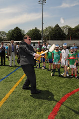